Tags
cherokee-indians, Guntersville Alabama, native-americans, northeast-alabama-history, trail-of-tears, turkeytown
Little Turkey is not his name. “Kanitta” is Little Turkey’s name. Major John Norton spelled Little Turkey’s name in his journal as “Kenneteagh”. This is a phonetic spelling of the name. Norton gives this explanation, “or as the interpreter improperly translated his name, The Little Turkey.” (Journal of Major John Norton pages 132-133 of the journal 1809-1810, Hathitrust.org). Little Turkey’s names also appear as Kennitea and Kungnitla.1
Norton does not provide the proper translation or true interpretation, nor does anyone else. The translation of “Kenneteagh” is not Little Turkey. However, “the Little Turkey” is how his name will be recorded in history. Michael Wren (Board member of Trail of Tears Association) asked several “Cherokee Talkers” what Kenneteagh would translate to. They all state the name was unknown but may translate as “Fawn Killer.”
Family
We learn a lot of Little Turkey’s family from the journal of Major John Norton, 1816. He was also a Mohawk Chief and Major in the British Army during the War of 1812. Major John Norton tells of his father who is a full-blood Cherokee being rescued and captured. The Toronto Champlain Society printed his journal in its entirety in 1970 with an introduction (explanations) by Carl F. Klinck and James L. Talman. Major John Norton was a Mohawk chief in Canada. However, he was raised in Scotland by his father and a British soldier. The soldier was present at the attack and destruction of the Kuwoki Town (Keowee) in 1760. John’s father was a boy who was rescued from a fire and taken by an unnamed British soldier. 2
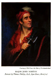
MAJOR JOHN NORTON
Portrait by Thomas Phillips, R.A., Syon House, Brentford3
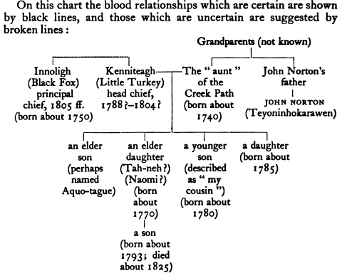
In 1809 Major Norton set out on a journey to find his family to pay honor to his father’s people. He met Turtle-at-Home and became friends. Turtle-at-Home is the son of Attakullatulla (Chief of the nation 1760-1775) he told Major Norton they would find his family. He escorted him to Estanaula. The elders there knew of his father’s story. The old chiefs told him that his father’s sister lived in Creek-Path (present-day Guntersville, Alabama). She was the widow of Kenniteagh, also known as Little Turkey. When he met his aunt at the Creek Path she explains the story and introduced him to his relatives.4
“In the mean time, the good old lady related the scene in which her brother was taken from her: she said, that she saw the officer rescue him after he had been scorched, on which account he was taken away in a wagon—and they were separated.”5
On page xxiv of the publication, her family is explained by Carl F. Klinck and James L. Talman in this way. His aunt (unnamed in the journal) was the sister of his father. “My father’s sister” (page 117 of the journal) was married to Little Turkey (Kennitea). Little Turkey, a “Head Chief of the nation, who has been dead some years”, is stated by Norton as a brother of Black Fox (Innoligh or Enoli).
“The next day, my cousin conducted me to visit his elder brother, his sister and uncle Innoligh, the leading Chief at present.” (page 118 of the journal) His aunt and Chief Little Turkey have these children whom he met. An elder son, Aquo-tague, and an elder daughter, Tah-neh. She changed her name to Naomi when she was baptized and became a Christian (born about 1770). A younger son unnamed described as “my cousin” (born about 1780), and a daughter (born about 1785). A grandson, son of Tah-neh, (born about 1793).
Did you catch this? “The next day, my cousin conducted me to visit his elder brother, his sister and uncle Innoligh, the leading Chief at present.” (page 118 of the journal).
Brothers?
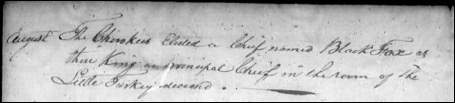
Chief Little Turkey and Black Fox (Innoligh) are brothers! If the children of Little Turkey introduce Norton to Chief Black Fox. Then Norton references Black Fox as their uncle.6 Then Little Turkey and Black Fox are brothers. Norton was raised as a Scott/English he would refer to familiar terms as the Scottish people would. Listing Innoligh as Little Turkey children’s uncle. Norton states Innoligh and Little Turkey have at least the same father. This is the only reference to this. If so, they must have different mothers. The Badger will refer to Black Fox as his nephew (Grand Council Meeting June 1792, page 273). If true, culturally Badger’s sister is Black Fox’s mother.7 But, she is not Little Turkey’s mother. Badger is listed in the Grand Council meeting in June 1792 as “the beloved man of the Southern division.” (page 271)8 This indicates that the Badger is from one of the Southern towns. Is he from Seneca or Keowee? Black Fox (Innoligh) is living in Creek Path when he meets John Norton. He will also die there. Black Fox will have his own post, more info to come. Lots of speculation. Yet, lots of concurring information.
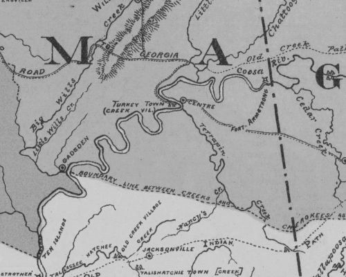
The towns on the headwaters of the Savanna River
The towns on the headwaters of the Savanna River are very important towns to the Cherokee Nation. They don’t get much attention.
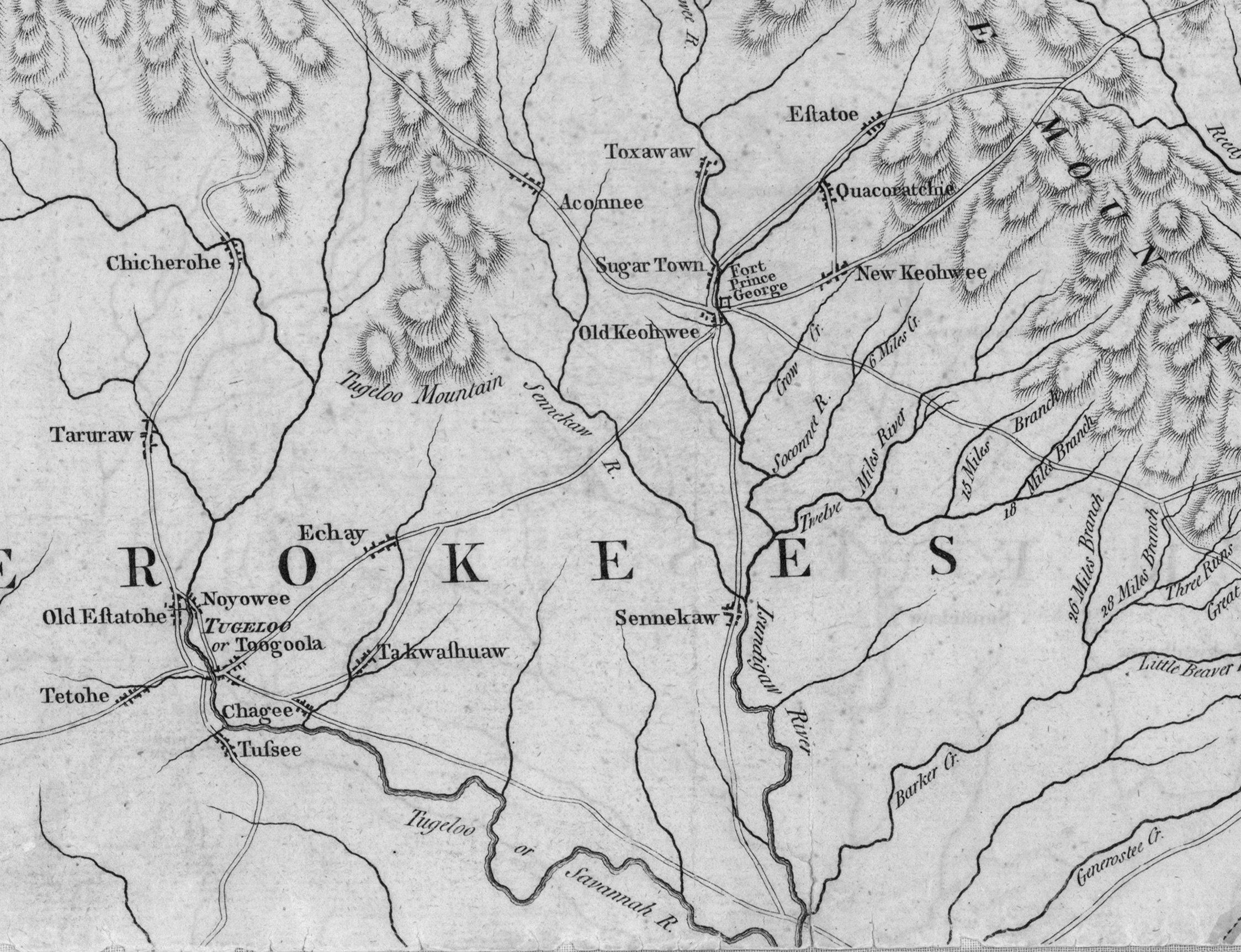
These towns and their people date back in time. In 1762 a delegation from the Cherokee Nation went to London England. The Southern towns are a project for a later time.
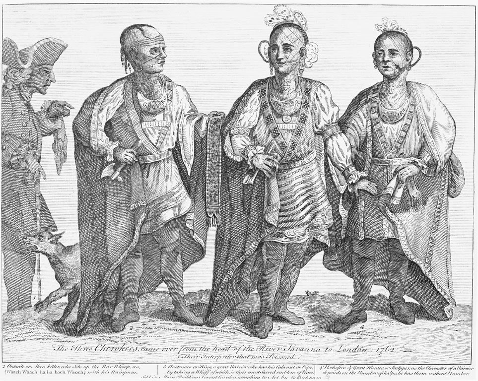
The person in the middle labeled as #3 is Chief Ostenaco.9 Osgenaco was the War Chief or Red Chief for the Cherokee Nation. He was on the expeditionary party to London England with Henry Timberlake in 1762. The expeditionary party consisted of Lieutenant Henry Timberlake, Sergeant Thomas Sumter, John McCormack (an interpreter), and an unnamed servant. They arrived in the Overhill Cherokee town of Tomotley on December 20, 1761. Ostenaco, one of the leading men in the town, greeted them. He was visiting from Keowee.10 Reminder Chief Little Turkey’s wife and Maj. Norton’s father is from Keowee.
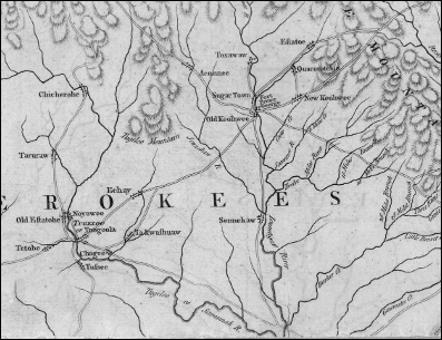
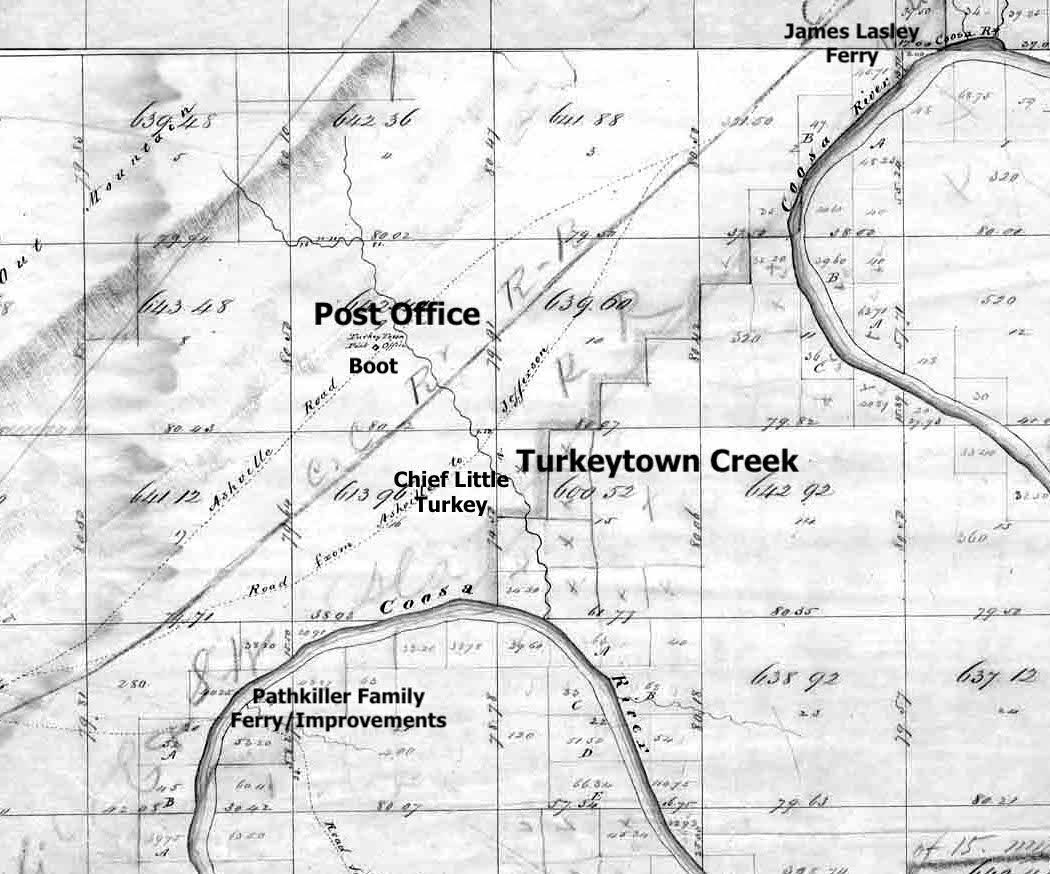
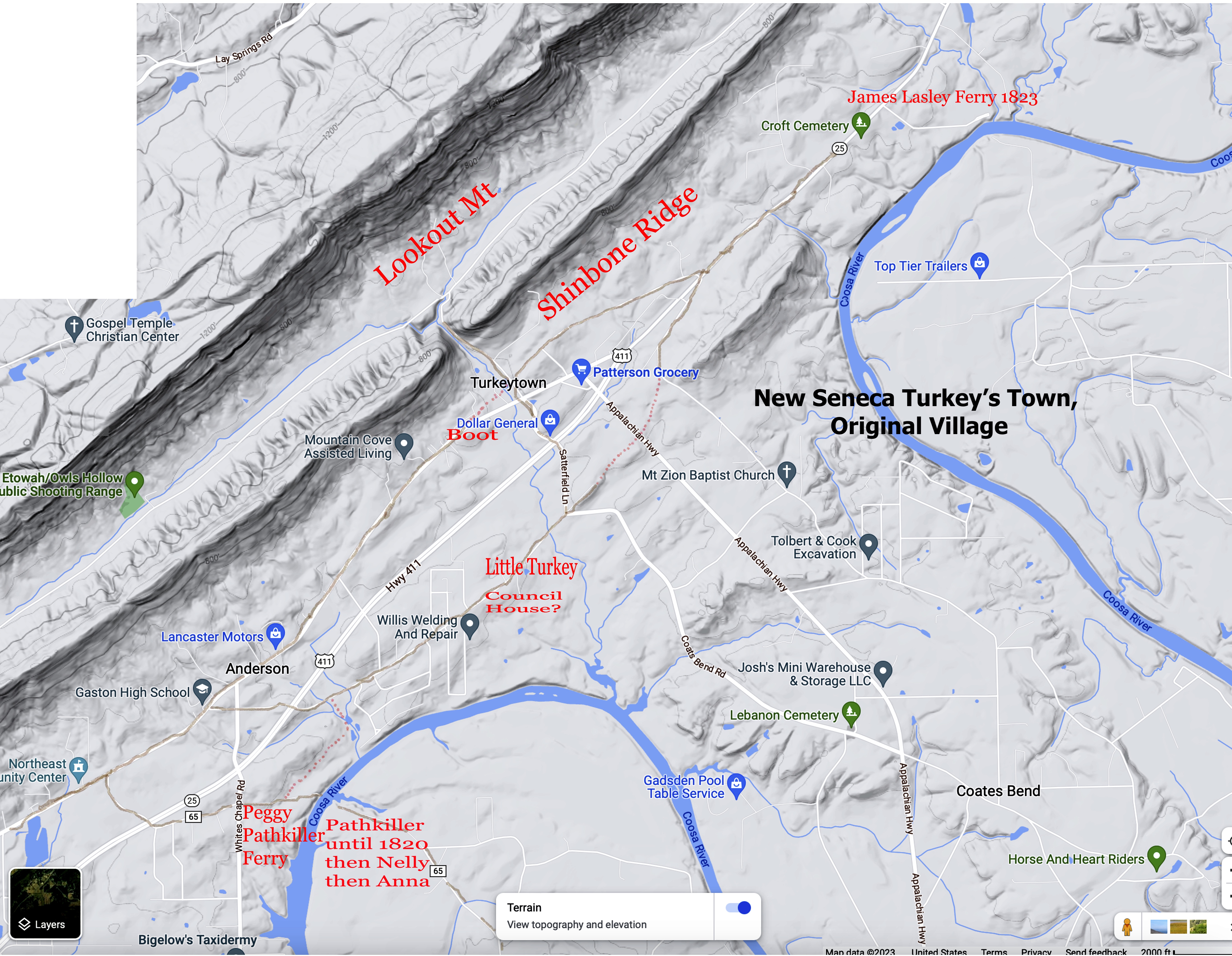
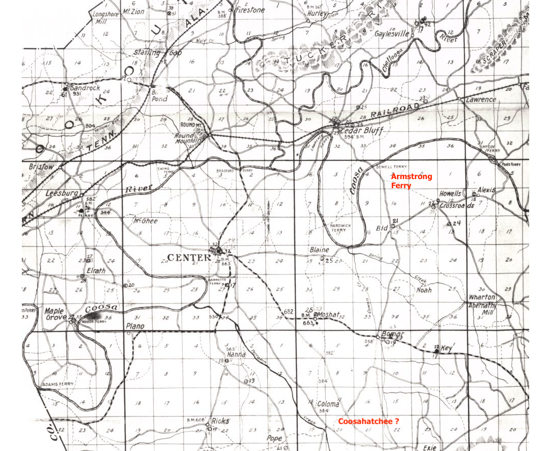
Family moves to Creek Path
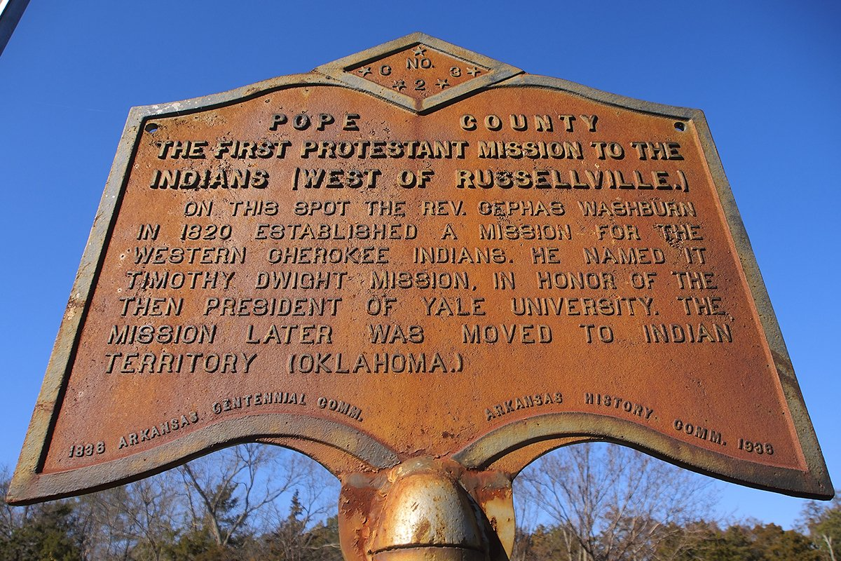
After Little Turkey’s death in 1802, his family moved to Creek Path. They settled near old family friend John Thompson. He was one of Little Turkey’s interpreters. John Thompson is listed as a bosom friend to Little Turkey (ASP, IA Vol. 1, page 432) Thompson’s final residence before removing west is near the Creek Path and he operated a large plantation. We see John Thompson escort Maj. John Norton to Creek Path from Oostanaula, page 117 of Norton’s journal. Little Turkey’s family moved to the West (Arkansas) around 1819.
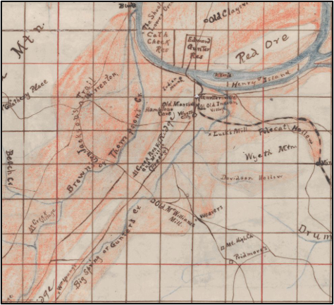
Notice Brown or Thompson Creek in the above map of Marshall County, Alabama. It is in the vicinity where Chief Little Turkey’s family lived before moving West. Brown is Rev. John Brown who was the Mission Teacher/Preacher for Creek Path also marked on the map. Modern-day this is under Lake Guntersville.
Daughter Tah-nee
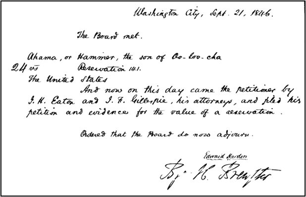
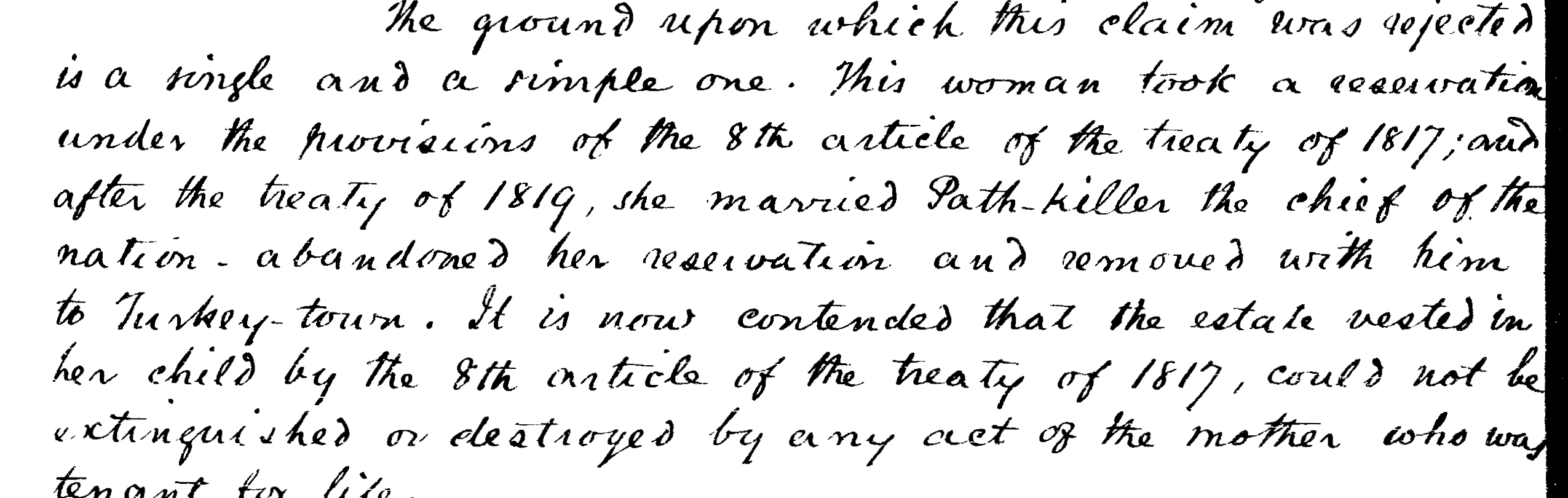
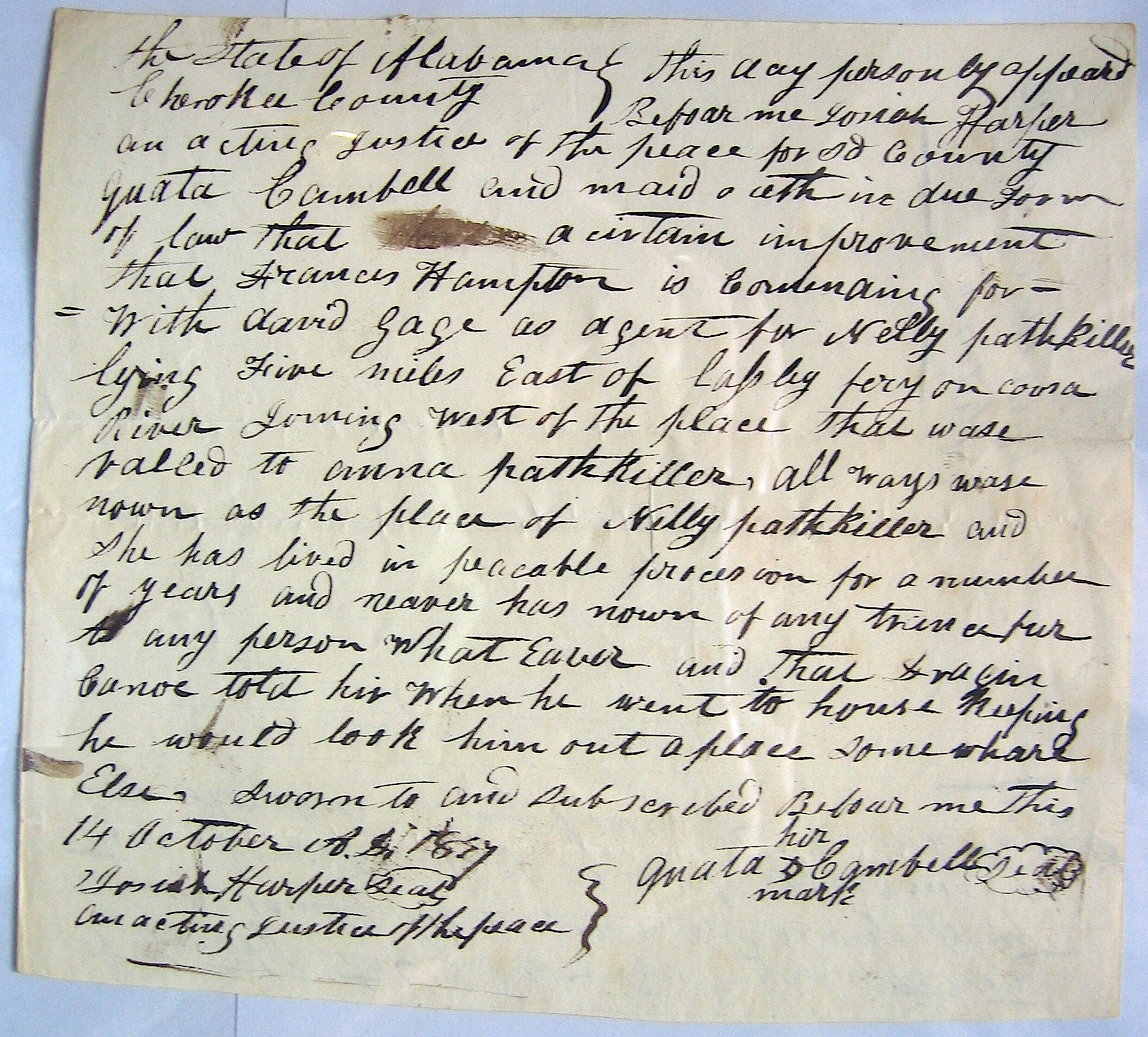
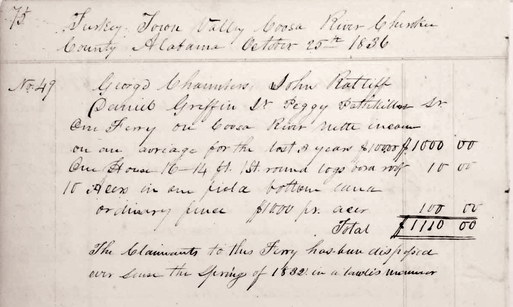
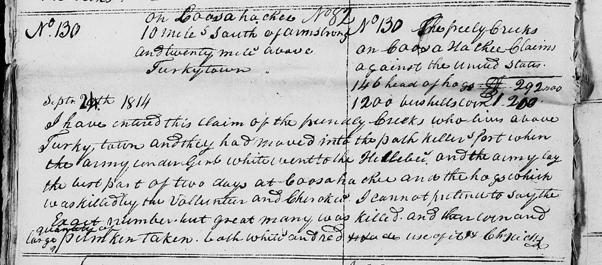
We learn about Little Turkey’s daughter Tah-neh (Dah-nee) or Naomi and her children from various sources. Wa-ka or Peggy Whitekiller, the daughter of Tah-neh and her husband Whitemankiller Watts. Peggy tells us about the family in her 1842 Canadian Claim (Claim book 1 #86). They abandoned property in the old nation and immigrated to the Arkansas territory with John Rogers in the year 1819.
“My mother lived on the improvements when we emigrated. She was married to Girth Jolly. I lived with them. We all came together to live in this country. Mother died fifteen years ago . . . I have one full sister. We live together. Neither of us are married. My sister is a widow. I have never been married. The property claimed for (us) belongs to me and my sister equally. Her name is Wattie or Betsy Girt. She has another claim. I was about 19 years of age when we emigrated. The improvements belong to my mother . . . We left soon after the treaty of 1816 and removed to Creek Path where we borrowed a place which we left when we started to this country. Don’t know whether my mother or step-father was ever paid any thing for improvement now claimed . . . My own father’s name was White-killer he died when I was about five years old. I now live on Salisaw 4 miles above mouth in Illinois.“
A witness of this claim; Stinking Fish, states;
“I knew the mother of Peggy Whitekiller in the Old Nation. Her name Dah-nee. She was widow of White-man-Killer and . . . wife of Girth Jolly . . . I lived about one quarter mile from her when she removed.”
The timeline has Peggy being born about 1800. She is 16 when they move to Creek-Path (1816). She is about 19 when they move west (1819). This timeline also shows her mother (Dah-nee) dying in 1827. Dwight Mission records, page 23, has her death on 31 March 1825. (Dwight Mission records provided by Jack Baker) Rev. Washburn in his book states the family emigrated in 1823-24. 11 The strong evidence from other reports and writings agrees with Peggy’s claim about their moves.12
“Her Indian name was Tah-nee. She was full blood, daughter of a considerable chief and warrior . . . She migrated to this country in 1819, then wife of Girth, son of John Jolly, head chief of this division of the Cherokees.”
The 1819 Emigration rolls include a “Dany of Will’s Town with 3 in the family.” They emigrate West in 1819. Girth Jolly is not named nor is he on the rolls.
One last child of Tah-neh, she adopts a son and the name given to him is Timothy Dwight.13
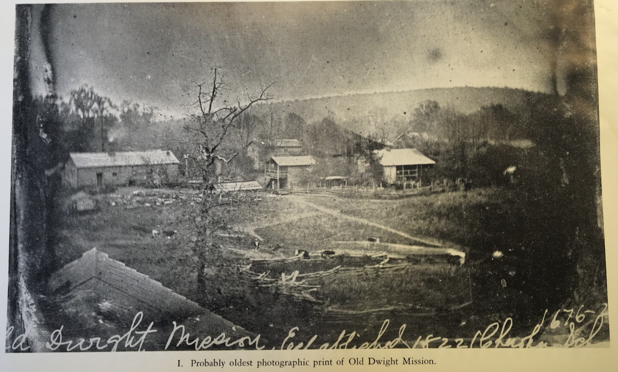
Little Turkey’s daughter Tah-neh (Naomi) and her elder son are buried in the old Dwight Mission cemetery. Their graves are near the parents of the beloved Cathern Brown, Reverend John and Sarah Brown.14 Browns are from Creek Path. Cathern was a teacher at the Creek Path Mission. She died at her home in Creek Path and is buried there. But, who else is buried in the original Dwight Mission cemetery? The cemetery is just about abandoned. The cemetery sits on a hill. It’s at a closed RV park. This RV park also owns the cemetery land. Mission RV Park is at 229 Mission Drive, Russellville, AR 72802. The location of the mission is underwater of the lake.
To Conclude
Little Turkey made his statement at the Nation’s Council meeting in October 1800. The Moravian missionaries Steiner and Schweintz were invited to attend. They recorded the meeting in their journal. This Council meeting was held at Estanaula (Oostanaula). This statement by Little Turkey was made at the close of the meeting. This was the time when the Council allowed a mission school to be built. The school was established at James Vann’s and (John) McDonald’s property. Mr. Vann had just donated property on his place. Spring Place, North West Georgia.
“You my warriors have grown up under my supervision. I have counseled you to treat the white people with caution, and now you are enjoying the happy results. You will know well how to use for the well-being of our Nation the addresses made in our meeting this time. We live in peace, and it makes me happy to see the chiefs of both halves of the Nation together in unity and friendship.” 15
Next post. The Beloved Chiefs from Turkeytown, Black Fox
- Journal of Major John Norton, introduction pages xxiv-xxvii, of the journal 1809-1810, Hathitrust.org; the latter spelling Cherokee Phoenix, 3rdDecember 1831 page 2 column 2a, http://www.wcu.edu/library/Digitalcollection/CherokeePhoenix/Vol4/no21/cherokee-phoenix-page2-2a.html ↩︎
- Journal of Major John Norton, introduction pages xxiv-xxvii, and pages 112-118 of the journal 1809-1810, Hathitrust.org ↩︎
- Ibid ↩︎
- Ibid ↩︎
- Ibid ↩︎
- Ibid ↩︎
- American state papers : Documents, legislative and executive, of the Congress of the United States / Selected and edited under the authority of Congress Indian affairs v. 1 1832, pages 271-273, 26 June – 1 July 1792) HathiTrust Digital Library https://babel.hathitrust.org/cgi/pt?id=mdp.35112103282408&seq=279&q1=turkey+town ↩︎
- Ibid ↩︎
- File:/collections/the-memoirs-of-lieut-henry-timberlake-1765/Three Cherokee.jpg ↩︎
- https://en.wikipedia.org/wiki/Ostenaco ↩︎
- Reminiscences of the Indians, by the Rev. Cephas Washburn, A. M., pages 147, 158-159 ↩︎
- Reel 740, frames 257-259 (Kutsche #3006) story of Naomi, American Board of Commission Foreign Missions (ABC-FM), 18.3.1 Vol 6, Item 81. ↩︎
- Dwight Journal September 1824, page 22, Kutsche #3012 ↩︎
- Reminiscences of the Indians, by the Rev. Cephas Washburn, A. M., pages 147, 158-159) (Note as to who is Cathern Brown; she is educated at the Brainerd Mission and is the first female teacher of the Creek-Path Mission. ↩︎
- page 212; Records of the Moravians Among the Cherokee, Early Contact and the Establishment of the First Mission, 1752-1802, Volume 1, C. Daniel Crews, Richard W. Starbuck, Editors; Cherokee National Press, Tahlequah, Oklahoma, 2010, Cherokee National Historical Society, Inc ↩︎
Trust in the Lord with all your heart, and do not rely on your own understanding;
in all your ways know him, and he will make your paths straight. Proverbs 3; 5-6 CSV